Four Acres Conserved on Sandy River
Parcels extend existing Barlow Trail site, protect salmon and steelhead habitat

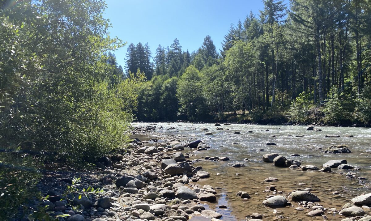
This fall Columbia Land Trust conserved four acres outside Brightwood, Oregon on the mainstem Sandy River. These newly conserved parcels are adjacent to our existing 26-acre Barlow Trail site. Together, the now 30-acre site conserves a section of the Sandy River and its shoreline, protects riparian forest, and creates space for the river to continue to move and change within the floodplain.
Even during summertime low flows, the waters that rush along the cobbly riverbank here are ice cold, fed by glacier melt at the Sandy’s headwaters on Mt Hood. Beaver, osprey, American dipper, flycatchers, deer and coyotes, and a host of other critters share the shoreline, floodplain, ponds and forest with the neighborhood’s human residents. The river and its side channels support endangered wild fish runs of winter steelhead and spring Chinook.
The history of this conservation project is unique. In December 1964, massive floods on this stretch of the Sandy River caused the river to avulse, redirecting out of its channel and carving a new pathway through the landscape.
Due to this flooding, and ongoing changes in the river channel over the last several decades, several privately owned tax lots that were previously on land are now partially or fully located on a small island in the river channel, or in the channel itself, and are no longer buildable.
Eight of these lots, totaling about four acres of land, eventually ended up under the ownership of Clackamas County, who in 2023 agreed to sell them to Columbia Land Trust. The newly conserved acreage will become part of our existing Barlow Trail site, which the Land Trust has stewarded since it was conserved in 2007.
In addition to destroying homes and temporarily stranding local residents, the 1964 Sandy River flood (and ensuing construction work intended to limit future flood damage) led to the deterioration of off-channel habitat that migrating salmon and steelhead depend on. The Sandy River is considered a stronghold for endangered fish populations in the lower Columbia River system, and the last two decades have seen a surge of fish habitat restoration efforts across the basin, intending to keep those populations healthy.
In 2016, the Sandy River Basin Watershed Council partnered with Columbia Land Trust to restore and improve salmon habitat along the river channel at the Barlow Trail site. The project removed a historic levee that was installed after the 1964 floods and restored a natural side channel along the river. Large log jams were installed at the inlet to the side channel, mimicking the natural log jams historically seen along the Sandy River, and helping guide water into the side channel and floodplain to create backwater areas and pools for salmon at critical times of year. The project was also designed to reduce the risk of erosion and channel migration for downstream neighborhoods adjacent to the river.
The newly conserved acreage includes portions of a large island between the river channel and the side channel, as well as sections of the shoreline on both sides of the river. Land Trust staff will incorporate the parcels into our long-term management plan for the Barlow Trail site and existing floodplain habitat. Stewardship activities include monitoring the restoration project to see that it is functioning as intended for salmon and steelhead, continuing to remove invasive weeds such as Scotch broom and knotweed, and allowing the public to enjoy the site while ensuring that this important habitat is protected.
“Four acres may not sound like a lot, but conserving this land is a win for nature and for the community,” said Natural Area Manager Emily Matson. “The Sandy River is so important to fish, to wildlife, and to people in our region. Permanently protecting the shoreline, even a small part, contributes to the larger goal of a healthy, functioning watershed now and in the future.”