Mapping Wildfire History
Research by Dr. Andrew Merschel reveals historic fire trends across elevations in Mt. Hood National Forest

(This is the second piece in our series on prescribed fire. Read the first blog here.)
Forests and fires have always been intertwined, but what exactly did this relationship look like in the Pacific Northwest and how can it help inform modern day land management? New scientific research reveals historical fire trends among a variety of forest types on the eastern flank of Mt. Hood, indicating that fire may have been a more frequent occurrence than many thought.
The East Cascades Oak Partnership (ECOP) hosted Dr. Andrew Merschel for a presentation of his research on “Historical Fire Regimes on the East Side of the Mt. Hood National Forest” as part of the partnership’s commitment to education and knowledge-sharing to help inform regional land management decisions. Andrew works for the United States Forest Service (USFS) Pacific Northwest Research Station and leads Oregon State University’s Laboratory of Tree Ring Research.
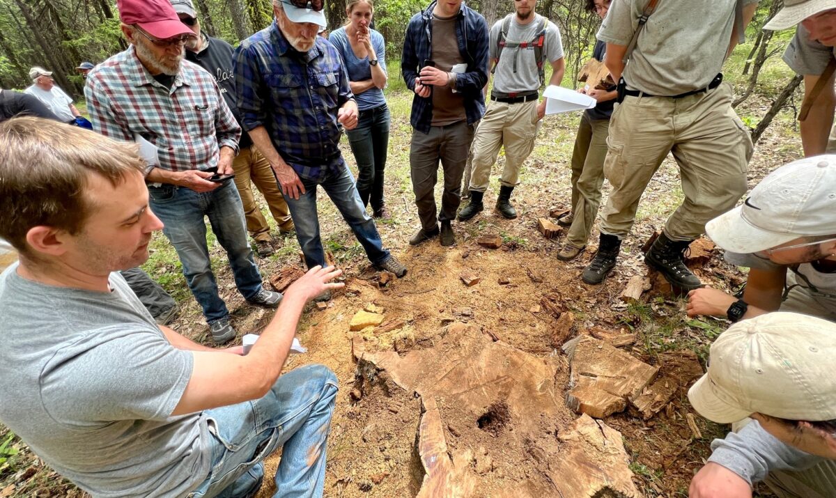
 Dendroecologists like Andrew study tree rings to develop an understanding of forest patterns over time. In this study, Andrew and colleagues examined fire scars on well-preserved stumps and logs across broad swaths of the east side Mt. Hood National Forest to approximate how regularly fires burned in different forest types. The team took samples from snags in low-elevation Oregon white oak forests, dry mixed woodlands, moist mixed-conifer and western hemlock forests, as well as cool, wet, high-elevation Pacific silver fir forests.
Regional Context
“The eastern Columbia River Gorge is dry, hot, windy and prone to lightning, which are all conditions that promote fire,” said ECOP Manager Lindsay Cornelius. “Indigenous elders interviewed by ECOP during our strategic planning process confirmed that fire was a routine occurrence in this landscape; a celebrated architect of fire-adapted First Foods like huckleberry, oak, and lomatium,” she said. “Fire history gives us important information about the conditions our forests are adapted to and insight into how management might make them more resilient to fire in the future.”
In his presentation, Andrew explained how present-day forest characteristics led to the team’s interest in studying this geographic area. Over the last century, fire exclusion in drier forests has led to structural changes in woodlands, with oak and pine trees overtopped by dense Douglas-fir canopies. In other cases, high-grading — selective commercial harvest of the largest and straightest trees — has led to the removal of older Douglas-fir and ponderosa pine trees in all forest types — two species which tolerate fire well when mature. (Young Douglas-firs are less fire tolerant than ponderosa pine, and many more were consumed as seedlings or saplings under historical fire regimes.)
The exclusion of low and moderate severity fires also led to a century of fuel accumulation and the development of denser forests composed of fire and drought sensitive species. These conditions increase the risk of high severity fires at a time when climate is becoming hotter and drier.
Research Process
The research team measured and crossdated each of the approximately 32,000 tree rings they sampled. Crossdating assigns calendar years to tree rings by leveraging the sensitivity of annual tree growth to climate. For example, thin rings generally form during warm, dry years, while thick rings indicate a cool, moist year. This relationship creates a kind of fingerprint that can allow annual growth rings to be dated to their exact year, even when sampled from trees that have been dead for decades or even centuries. Knowing the exact date of each tree ring is critical to accurately reconstructing the timeline of historical droughts and fires across a study landscape.

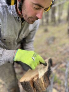
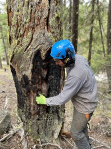
After crossdating the researchers were able to assign fire scars in cross sections removed from stumps and logs to the exact year they formed. Fire scars form when a tree is exposed to low or moderate severity fire that heats through bark but doesn’t kill the tree. Most previous studies performed on Northwest forests didn’t crossdate fire scars, making this research a significant step forward in understanding fire frequency and the influence of fire on forest conditions and development in Oregon.
Learnings
Andrew’s study analyzed tree samples from eighteen different sites spaced eight kilometers apart in low to high elevation forests directly east of Mt. Hood. The team discovered that for centuries, low to mid intensity fires occurred in all major forest types at all elevations in the study area, although frequency did vary among forest types.
For example, at a low elevation test site near the White River Wildlife Area, the Oregon white oak and dry mixed-conifer forest has experienced fire exclusion for decades, resulting in a dense conifer-dominated stand. After crossdating each tree sample, the research team found evidence of fire as far back as the late 1400’s. Each of the samples revealed that fire was frequent, occurring at a six-year interval (about 17 times a century) in what was historically a multi-aged and more open oak and pine-dominated woodland.
Around 1870, fire became less frequent in this area, before ceasing altogether in 1888. In a forest that saw fire every six years on average for hundreds of years, it has been 130 years since the last one. The fuel that would’ve been consumed by those 21 missing fires has accumulated on the landscape and species that would’ve been discouraged by fire have proliferated, making the system more prone to severe fire.
The East Cascades Oak Partnership is working to remedy that. Partners including Columbia Land Trust, Lupine Forest LLC, Natural Resources Conservation Service, USFS, Oregon Department of Forestry, Confederated Tribes of the Warm Springs, and Oregon Department of Fish & Wildlife are investing funds from the Oregon Watershed Enhancement Board, Joint Chiefs’ Landscape Restoration Partnership, Senate Bill 762, and Community Wildfire Defense grants to remove accumulated fuels, and are exploring the reintroduction of healthy fire through controlled burns. These actions set the stage for lower intensity fires, benefiting both people and nature.
The research team made another surprising discovery, that fire was also routine in cooler and moister mixed conifer forest sites at both mid and high-elevations, occurring at least three or four times a century.
The study also indicated that old growth forests, known for supporting diverse ecosystems and sequestering significant amounts of atmospheric carbon, developed with occasional low to moderate intensity fires, as opposed to no fire at all. This suggests that many of features of old-growth forest including several tree age classes, diverse species composition, multilayered canopies, and the presence of snags and logs, occur because of fire, not the absence of fire.
Andrew and colleagues were able to create a year-by-year record of historical forest fire frequency in the east Mt. Hood region. This will provide community members and regional land management organizations like Columbia Land Trust with valuable information about regional fire patterns that can help inform future conservation and restoration efforts.
Learn more about the East Cascades Oak Partnership.
Read Andrew Merschel’s summary of east Mt. Hood National Forest fire records.
Read additional research by Keala Hagmann on Fire behavior and forest conditions in Mt. Hood National Forest.